
The Database of British and Irish Hills (DOBIH) now includes almost 20000 hills plus several hundred assorted oddities such as points on slopes or on political boundaries. The majority of these hills are Tumps - 16736 of them in Britain in version 14.2 of the database. This huge dataset, the result of a dedicated collaborative effort, makes it possible to carry out a detailed analysis of hill distribution.
Most of us are used to a familiar framework of hill areas based on countries, ranges, regions, sections, Landranger maps and counties. For no particular reason other than curiosity, I decided to analyse this dataset with reference to OS grid squares of different sizes, using the three main categories of relative hill in DOBIH - Marilyns, Humps and Tumps (P150, P100 and P30). This article summarises the findings.
I found four instances of two pairs of Tumps with the same six-figure grid reference:
HU289417: Erne's Stack and Erne's Stack East (Shetland Mainland)
NT909695: Floater Rock and East Hurker (St Abb's Head, Borders)
SR926944: Elegug Tower and Elegug Spire (Pembrokeshire)
SW754594: Carter's Rocks North and Carter's Rocks South (Cornwall)
All of these are sea stacks less than 60m high and none have as yet been logged on hill-bagging.co.uk. Two other hills with the same grid reference are Sgurr Alasdair and Sgurr Thearlaich at NG450207 on Skye, but Sgurr Thearlaich is not a Tump as its drop is only about 20m.
Only two 1km grid squares contain two Marilyns:
NM9096: Sgurr na Ciche and Garbh Chioch Mhor, Knoydart
NN9233: Meall nan Caorach and Meall Reamhar, Perthshire
This does not necessarily make them the closest pairs of Marilyns, as adjacent hills may be in different grid squares, so I had to do a bit of programming to take that into account. According to my algorithm, using ten-figure grid references where available, the pairs of Marilyns nearest to each other, irrespective of grid square, are:
| Apart | Marilyn pairs | Section |
| 0.88km | Ainshval (781m) and Trollabhal (702m) | 17D |
| 0.91km | Meall nan Caorach (624m) and Meall Reamhar (618m) | 1A |
| 0.94km | Sgurr na Ciche (1040m) and Garbh Chioch Mhor (1013m) | 10B |
| 0.98km | Sgurr Alasdair (992m) and Inaccessible Pinnacle (986m) | 17B |
| 1.07km | Sgurr na Coinnich (739m) and Beinn na Caillich (732m) | 17C |
| 1.09km | South Lee (281m) and North Lee (263m) | 24C |
| 1.11km | Mullach Coire Mhic Fhearchair (1016m) and Sgurr Ban (989m) | 14A |
| 1.12km | Mullach an Eilein, Boreray (384m) and Stac an Armin (196m) | 25 |
| 1.20km | Ben More Coigach (743m) and Sgurr an Fhidhleir (705m) | 16F |
| 1.24km | Stac Lee (172m) and Mullach an Eilein, Boreray (384m) | 25 |
| 1.25km | Meall a'Bhuiridh (1108m) and Creise (1100m) | 3C |
The closest pair of Marilyns in England are Fairfield and Seat Sandal, 1.47km apart, then Great Gable and Kirk Fell, 1.61km apart. The closest pair in Wales are Pen Llithrig y Wrach and Creigiau Gleision, 1.48km apart, then Snowdon and Y Lliwedd, 1.63km apart. All these figures refer to direct aerial distances, not walking routes.
There are five 1km grid squares that contain two Humps; NM9096 and NN9233 as above, plus:
NG8765: Baosbheinn and Baosbheinn East Top, Flowerdale
NN1454: Bidean nam Bian and Stob Coire nan Lochan, Glen Coe
NN1866: An Gearanach and Stob Coire a'Chairn, Mamores

An Gearanach and An Garbhanach (photo: Alan Dawson)
The pairs of Humps that are closer to each other than the closest pair of Marilyns are shown below:
| Apart | Non-Marilyn Hump pairs | Section |
| 0.72km | Baosbheinn (875m) - Baosbheinn East Top (802m) | 13A |
| 0.72km | Uisgneabhal Mor (729m) - Teileasbhal (697m), Harris | 24B |
| 0.76km | Sgurr Mhor (986m) - Na Rathanan (864m), Beinn Alligin | 13A |
| 0.80km | Sgurr Fhuaran (1067m) - Sgurr na Carnach (1002m) | 11A |
| 0.80km | Sgurr a'Ghreadaidh (973m) - Sgurr na Banachdich (965m) | 17B |
| 0.82km | Bidean nam Bian (1150m) - Stob Coire nan Lochan (1115m) | 3B |
| 0.84km | Meall an Uillt Chaoil (844m) - Beinn an Tuim (810m) | 10D |
| 0.84km | An Coileach (389m) - Ceann Reamhar na Sroine (357m), Harris | 24B |
| 0.85km | Bidein a'Ghlas Thuill (1062m) - Sgurr Fiona (1060m) | 14A |
| 0.85km | Meall Garbh (1123m) - An Stuc (1117m) | 2B |
| 0.85km | Sail Mhor (980m) - Coinneach Mhor (976m), Beinn Eighe | 13A |
| 0.85km | Bioda Buidhe (466m) - Cleat (336m), Trotternish | 17A |
| 0.85km | Carnan (273m) - Arnamuil (121m), Mingulay | 24D |
| 0.87km | Sgor na h-Ulaidh (994m) - Stob an Fhuarain (968m) | 3B |
| 0.88km | Sgor Gaibhre (955m) - Sgor Choinnich (929m) | 4B |
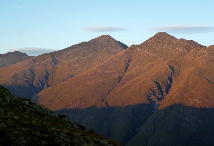
Sgurr Fhuaran and Sgurr na Carnach (photo: Alan Dawson)
The closest pair of Humps in England are Coniston Old Man and Dow Crag, 0.99km apart, then Scafell Pike and Scafell, 1.14km apart. The closest pair of Humps in Wales are Moelwyn Mawr and Moelwyn Bach, 1.14km apart, then Pen y Fan and Cribyn, 1.21km apart.
The Marilyns that are furthest from any other Marilyn are:
The Humps furthest from any other Hump are:
There are 15873 grid squares that include one or more Tump, 711 that include two or more, 61 with three or more, 17 with four or more, and two grid squares that include five Tumps: HP6019 (Muckle Flugga) and HU2742 (stacks off Shetland Mainland).
Of the 17 squares with at least four Tumps, eight are in Shetland (Mainland four, Unst three, Fair Isle one), two are in the Flannan Isles, one on Handa Island, three on Skye (two Cuillin, one Trotternish), two at St Abb's Head and one at Ramsey Island off Pembrokeshire.
Of the 61 squares with three or more Tumps, 57 are in Scotland, two are in Wales: SM7022 (Ramsey Island) and SH7524 (Coed-y-Brenin) and two are in England: SW8977 (Gunver Head, Cornwall) and SJ5729 (Hawkstone Park, Shropshire). Two of those at Hawkstone Park are judged to have exactly 30m drop, while Grotto Hill is a potential fourth Tump in SJ5729.
Of the Tumps over 600m high (the Sims), the closest pair are The Cobbler and The Cobbler South Peak, just 0.13km apart. There are six other pairs under 0.2km apart: three pairs are on Skye, one on Arran, one on Suilven and one on Aonach Eagach.
The most isolated Sims are Cauldcleuch Head and Peel Fell (17km apart), then Black Combe (16.5km from Harter Fell), Craig y Llyn (15km from Fan Nedd), Pressendye (12.4km from Morven) and Tinto (10km from Hudderstone).
Two 10km x 10km grid squares contain ten Marilyns: NH07 (Fisherfield, highest is Mullach Coire Mhic Fhearchair) and NN20 (Argyll, highest is Beinn Ime). Four 10km grid squares include nine Marilyns: NG52 (Skye), NG95 (Torridon), NN33 (Bridge of Orchy - Tyndrum) and NR94 (Arran). A further three squares include eight Marilyns: NM99, NN04 and NN15. The most in Wales is six: SH65 (Snowdonia), while SH55 has five Marilyns. The most Marilyns in a 10km grid square in England is five: NY11 (Cumbria).
NN15 (Glen Coe) is the 10km grid square with the most Humps (15), followed by NG52, NG91, NN20 and NR94, with 13 each. England does much better with Humps than Marilyns, as NY20 has ten and NY21 has nine. The Humpiest 10km grid square in Wales is SN98, centred on Llanidloes, with seven Humps.
The 10km grid square with the most Tumps is NG87 with 61, seven more than any other square. This covers the area between Gairloch, Poolewe and Loch Maree. It has only two Marilyns, with 420m Meall an Doirein the highest. NG98 to the east of Poolewe has 40 Tumps but just the one Marilyn (Beinn a'Chaisgein Beag). Six of the twelve squares with 40 or more Tumps are in the far north-west: NC25 (54), NC14 (50), NC11 (49), NC12 (44), NC13 (40) and NC24 (40). All rather a long way from Peterborough. Three of the other squares with 40+ Tumps are clustered around Ardfern: NM80 and NM81 with 43 each and NR89 with 40, while NB13 on North Lewis has 41 Tumps to occupy baggers waiting for a boat from Miabhaig.
But what about England, where most Tumpers live? NY20 and NY21 have 30 each so are hilly but only half as hilly as NG87. Outside Cumbria the next densest squares in England are SY49 around Bridport in Dorset with 22 Tumps, SX76 near Totnes in Devon with 19, and SK06 south of Buxton in Derbyshire with 18. Best in the south-east are SU71 with 11 and TQ14 with seven.
The best haul in Wales is to be found in SN79 south of Machynlleth, where there are 35, with another 30 in SN78 to the south. SJ11 near Welshpool also has 30 to keep the local surveyor busy.
Finally, the big letter finish. There are 54 100km x 100km grid squares that contain at least one Tump, or 55 if you include SC for the Isle of Man. Bagging the highest Tump in each of these huge squares could be a fine new challenge for anyone wishing to explore the whole of the country, including that strange wasteland where grid letters start with T.

The scenic summit of SC (photo: Alan Dawson)
How hard can it be to climb a mere 55 hills? As usual, there is a joker in the pack. Square HX contains just one Tump but it is a tricky one: Sule Stack at HX561179. This is a mere 37m high but it is a logistical challenge even for the dedicated island bagger who has already landed in HW. The photo on Geograph makes Sule Stack look relatively benign compared to some of the Humps. According to the website of Charles Tait photographic services, it is 'relatively easy to land on in good conditions, but rarely visited due to its remote position'. It is not the only one of these 55 Tumps that had not been logged on hill-bagging.co.uk by the end of 2014, so opportunity knocks for the willing.
So here is the table of those 55 big grid squares (each larger than the area of six Landranger maps), showing the number of Marilyns, Humps and Tumps, as well as the highest Tump in each, according to version 14.2 of DOBIH. There is a pleasing correlation in the top seven squares between the number of Tumps and the height of the highest Tump. In version 14.1 of the database there were precisely 1344 Tumps in NN, but one was annoyingly added for version 14.2. This was very probably my fault; I will need to survey and demote a marginal one or more to return the total to 1344. There are plenty to choose from.
| Sq | Marilyns | Humps | Tumps | Highest Tump | Height | Drop |
| NN | 296 | 447 | 1345 | Ben Nevis | 1344 | 1344 |
| NH | 165 | 294 | 1171 | Cairn Lochan | 1216 | 90 |
| NG | 135 | 235 | 1052 | Sgurr Fhuaran | 1069 | 663 |
| NM | 128 | 197 | 986 | Sgurr na Ciche | 1040 | 839 |
| NC | 74 | 141 | 955 | Ben More Assynt | 998 | 835 |
| NT | 57 | 139 | 873 | Broad Law | 840 | 653 |
| SN | 39 | 103 | 797 | Fan Brycheiniog | 803 | 424 |
| SO | 51 | 123 | 716 | Pen y Fan | 886 | 668 |
| NO | 61 | 127 | 678 | Beinn a'Bhuird South Top | 1179 | 50 |
| SH | 64 | 130 | 664 | Snowdon | 1085 | 1039 |
| NS | 55 | 123 | 648 | Beinn Bheula | 779 | 557 |
| NY | 59 | 117 | 641 | Scafell Pike | 978 | 912 |
| NR | 44 | 83 | 595 | Goat Fell (Arran) | 874 | 874 |
| NX | 39 | 89 | 557 | Merrick | 843 | 705 |
| NJ | 50 | 94 | 509 | Cairn Gorm | 1245 | 146 |
| SJ | 23 | 63 | 471 | Cadair Berwyn | 832 | 346 |
| SD | 44 | 79 | 451 | Coniston Old Man | 803 | 416 |
| NB | 37 | 71 | 448 | An Cliseam (Harris) | 799 | 799 |
| HU | 14 | 27 | 399 | Ronas Hill (Shetland) | 450 | 450 |
| ST | 15 | 33 | 351 | Mynydd Twyn-glas | 472 | 253 |
| SX | 3 | 17 | 348 | High Willhays | 621 | 537 |
| SS | 6 | 21 | 271 | Werfa | 568 | 90 |
| SK | 2 | 18 | 231 | Kinder Scout | 636 | 497 |
| SU | 3 | 13 | 180 | Walbury Hill | 297 | 188 |
| SE | 4 | 15 | 166 | Great Whernside | 704 | 288 |
| NF | 21 | 38 | 156 | Beinn Mhor (South Uist) | 620 | 620 |
| TQ | 9 | 20 | 138 | Leith Hill | 295 | 246 |
| SP | 1 | 11 | 110 | Seven Wells Hill | 319 | 121 |
| NZ | 5 | 12 | 92 | Hoove | 555 | 180 |
| SY | 2 | 8 | 92 | Lambert's Castle Hill | 258 | 121 |
| ND | 8 | 15 | 91 | Morven | 706 | 574 |
| SW | 3 | 4 | 87 | Hensbarrow Beacon | 312 | 193 |
| HY | 8 | 15 | 75 | Ward Hill (Hoy) | 481 | 481 |
| SM | 0 | 5 | 65 | Ysgubor Mountain | 232 | 47 |
| NU | 2 | 4 | 48 | Cochrane Pike | 335 | 38 |
| HP | 2 | 5 | 46 | Saxa Vord (Unst) | 284 | 284 |
| SC | 5 | 11 | 46 | Snaefell | 621 | 621 |
| NL | 8 | 12 | 44 | Sheabhal (Barra) | 384 | 384 |
| NA | 6 | 7 | 36 | Conachair (Hirta) | 430 | 430 |
| SZ | 3 | 7 | 31 | St Boniface Down (IoW) | 241 | 241 |
| HZ | 1 | 2 | 21 | Ward Hill (Fair Isle) | 220 | 220 |
| SV | 0 | 0 | 20 | Higher Newford (St Mary's) | 51 | 51 |
| TF | 1 | 1 | 15 | Normanby Top | 168 | 162 |
| TL | 0 | 1 | 13 | Dunstable Downs | 243 | 105 |
| TR | 1 | 1 | 11 | Cheriton Hill | 188 | 150 |
| TA | 0 | 2 | 9 | Seamer Beacon | 189 | 146 |
| NK | 0 | 0 | 6 | Smallburn Hill | 143 | 41 |
| TG | 0 | 0 | 5 | Beacon Hill | 105 | 79 |
| SR | 0 | 0 | 5 | Maiden Wells Hill | 89 | 47 |
| NW | 0 | 0 | 5 | Killantrigan Fell | 151 | 42 |
| HW | 0 | 1 | 4 | Tobha Ronaigh (Rona) | 108 | 108 |
| HT | 2 | 2 | 4 | Da Sneug (Foula) | 418 | 418 |
| TM | 0 | 0 | 2 | Highfield Hill | 73 | 30 |
| TV | 0 | 0 | 2 | Seaford Head | 86 | 53 |
| HX | 0 | 0 | 1 | Sule Stack | 37 | 37 |

