
Mark Bull: There are two cairns, which seem to correspond to the two 910m contours on the Explorer map (and not to the cairn marked on the Explorer, which is between the two contours). It appeared to me that the western cairn, in the larger contour ring, is higher, by around 3m. A line of sight from the west to east cairn passes close to Ben Hope (927m), so it is easy enough to judge the relative heights. The east cairn is about 1.5m high, but it would need to be about three times as high to make its top appear level with Ben Hope. At first I thought that the west cairn might exceed the magic number, but 914m for the east cairn seems a bit unlikely: the contour ring appears too small to contain a 4m rise, as the ground is not very steep. My best guess is that the west cairn is 914m, the east is 911m, and so the OS have the height correct but not the summit location.
Stewart Logan: This hill, mapped at 601m, has a potential twin peak in Cruach a'Chanuill, which has a 600m contour. When I went up Sgorach Mor, the GPS read 601m. I wandered over to the other summit, where there are actually two points 100 to 200 metres apart. On the first the GPS read 606m, and on the second it hovered between 611m and 612m. To my eye the higher point looked above Sgorach Mor and on a par with 607m Cruach Neuran across the valley.
Following Colin Crawford's findings about two Arran SubMarilyns (reported in Marhofn 93), further research has been carried out and is worth reporting:
OS maps give 556m for summit, 408m for col. Harvey map gives 557m summit, 407m for col.
Alan Dawson: My impression was that the highest point was 100m south of the cairn. Altimeter reading confirmed this, just reaching 560m, compated to 405m at the col.
Graham Illing: We took two GPSs and both ended up with a col-to-summit height difference of 147m (although the quoted altitudes were different).
OS maps give 480m for summit, 331m for col. Harvey map gives 481m for summit, 328m for col.
Ann Bowker: Summit reading set to 480m, went down to the col and got readings fluctuating between 327m and 330m but mainly 329m. The col is very flat and it's difficult to pick the point where water was flowing away in both directions. Went back up to the top and it was still reading 480m (with occasional fluctuations between 479m and 481m).
Graham Illing: Only one GPS available and we obtained a height difference of exactly 150m.
Alan Dawson: It's hard to pin down the precise col location. On all likely points the altimeter reading stayed steady at 320m, occasionally flicking to 325m, compared to a summit reading of 480m.
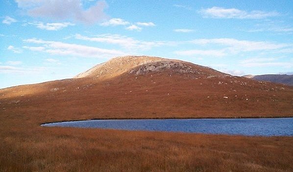
Sail Chalmadale, Arran
Graham Bunn: The Explorer map (Ex401) is quite interesting. I noted that Corrieyairack Hill has reverted back to its previous top and height (896m at NN428998). We actually did the hill, and our observations confirmed that this top is higher than that at NN429995. This takes it back to the same height as Gairbeinn. Will Corbett status follow?
Alan Dawson: Having finally found someone at the Ordnance Survey (Jean Dalton) who was prepared to take the trouble to research the answers to difficult questions, I thought I would lob a couple of long-standing uncertainties in her direction to see if they could be resolved once and for all. She was extremely helpful, and the answers obtained are as definitive as it is possible to get from the information held by the OS, though still not entirely convincing. The response is given in some detail below as it represents a semi-official ruling about interpreting differences in spot heights from different scales of map.
Jean Dalton: I have looked at both of the original 1966/67 imperial contour documents for Gairbeinn and Corrieyairack Hill, and they both categorically state that their heights are 2940 feet. There is no indication on either document of any further decimal points of height. I asked our geodetic survey computations team if they had a record of any further top heights for these hills, and their answer was no. When they did a metric re-survey of the contours in 1977, I am told that the photogrammetric survey team used the same points wherever possible for their spot heights and then metricated the imperial heights, which is where the discrepancy (on the 1:10000 map) appears to occur. However, the 1977 metric document shows an air height of 891m for Corrieyairack Hill and an 895m value for Gairbeinn, neither of which are the metric equivalent of 2940 feet.
Two days later I was able to speak to one of the chief surveyors in our photogrammetric survey area. He gave me a definitive line on which heighting information to take for the majority of problems in basic survey areas in Scotland. He says that ideally we should be using the 1:10000 metric contour re-survey information from the 1970s, as that will be the most accurate and up-to-date information. He confirms that in the majority of cases the heights on these documents were re-heighted more accurately by air machine methods, and that only in about 10% of cases (his rough estimate) were the imperial heights transferred across and metricated. Many of the height discrepancies on Landrangers come from the metricated imperial heights used on the first series 1:50000 maps made from the one-inch maps. Although the heights now are supposed to be made to match the 1:10000 and 1:25000 scale heighting, it seems that we have a way to go to fully achieve this. He tells me that the imperial heighting has not come from the most reliable survey methods, as they were invariably produced using local sea levels and taking vertical angles; not the most accurate methods around today.
On this basis (using the metric air survey), I will now have to say that the confirmed heights are: Corrieyairack Hill 891m, Gairbeinn 895m, both from 1977 air heights.
Jean Dalton: Metric height is 608m. There is no evidence on the metric contour document for the existence of a 610m height or contour.
